Call a local advisor
+86 186 1196 4400Email our team
[email protected]Tour Beijing Journal
The low elevation of Yajiang (雅江) did give us a good sleep last night. Early this morning, 10 October, we continue our self-drive west along the National
The low elevation of Yajiang (雅江) did give us a good sleep last night. Early this morning, 10 October, we continue our self-drive west along the National Highway G318 from Yajiang (雅江) to Litang ( 理塘), where we are going to head south to get to our final destination today - Daocheng (稻城).
The 138 km drive from Yajiang to Litang reminds us of the overland from Kangding to Xinduqiao, where we had to ascend the high Zheduo Pass at 4290 meters; for the road trip from Xinduqiao to Yajiang, we also had to climb over the high pass of Gaoersi Pass at 4412 meters.
Now today here from Yajiang to Litang, we have to go over Kazila Pass (卡子拉山口) at the elevation of 4718 meters, the highest pass on our trip so far.

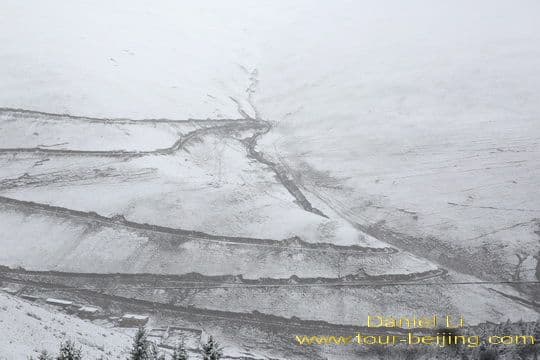
It is again snowing due to the high elevation as we are driving up higher and higher from the low elevation of Yajiang to the high mountains on route, which all surpass 4000 meters.
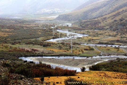
The golden and yellow meadows and autumn leaves, and green pine trees are covered with white snow. We drive meticulously along the switchback mountain roads and take a break if necessary at the service stops run by the local Tibetans.
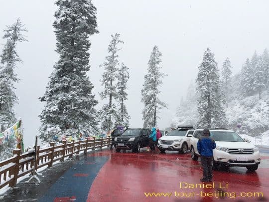
We take a break at the service stop on the way up to Kazila Pass.
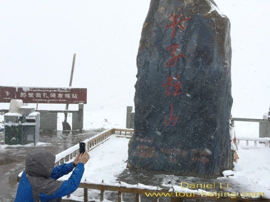
At 10:30 am, we get onto the high Kazila Pass at the elevation of 4718 meters. People are snapping pictures of the huge rock sign indicating the name of the pass in Chinese - 卡子拉山口.
Climbing over the pass, we begin to go down and the highway condition is much better than we expect, wide and flat.
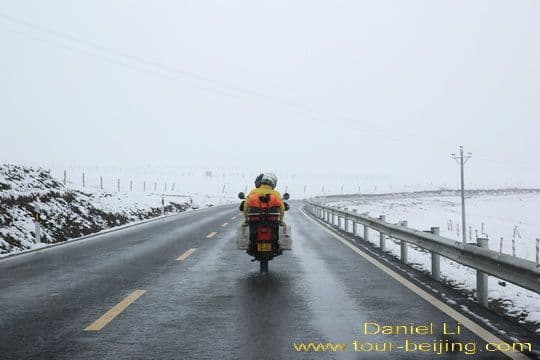
On the way down to Litang Town, we also find a motorcyclist couple driving along the National Highway before us.
Going over the high Kazila Pass, we soon find the weather is getting better. Snow stops and the mountains passing by turn multi-coloured with beautiful valleys - grazing yaks, limpid streams and yellow meadows.
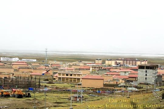
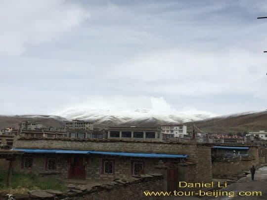
Litang Town (理塘) at the elevation of 4014 meters is the seat of Litang County, 400 meters higher than Lhasa, one of the highest town in the world.
"Litang" in Tibet literally means "Copper Mirror-like plateau" as it is located on the flat plateau with surrounding mountains.
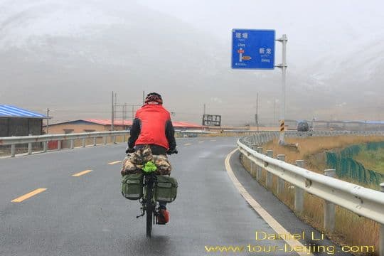
A cyclist is biking towards Litang Town.
Litang Town is situated on the flat plateau surrounded with mountains. It is under the administration of Ganzi Tibetan Autonomous Prefecture, on the west Sichuan Province.
At Litang, we get off the National Highway G318 and turn south and drive along S217 to get to Daocheng.
Litang Town is an important base either for travelers going from Chengdu to Lhasa or to Daocheng. It is an old, but booming town with the coming of more and more travelers on their way to Daocheng or Lhasa.
Hotels and restaurants are seen dotted here and there in the town. At 12:15 am, we stop for lunch in Litang before we start for Daocheng along the provincial highway known as S217, which later turns out to be a super highway with beautiful landscapes.
Any questions on the way from Yajiang to Litang, just drop a line.
Drive from Hanzhong to Ya’an Ya’an Night View Most Beautiful Sky Road in China Moxi Old Town ( Tips, Photos & Map) Hailuogou Glacier Camp No.04 (Tips,Photos & Map) Hailuogou Glacier Camp No.03 (Tips, Photos & Map) Kangding (Tips, Photos & Map) Drive from Kangding to Xinduqiao Drive from Xinduqiao to Danba Jiarong Tibetan Blockhouses Jiarong Tibetan Ancient Watchtowers Drive from Xinduqiao to Yajiang Drive from Yajiang to Litang Drive from Litang to Daocheng Drive from Litang to Batang Drive from Batang to Mangkang Drive from Shangri-la to Daocheng Drive from Daocheng to Yading Yading Brings You Inner Peace
Hand-picked routes matched from this post's destination clues, tags, and categories.
Use these attraction notes to connect nearby sights with tours, destination guides, and planning articles.
Subscribe to receive Beijing travel ideas and tour updates.


Leave a Reply
Share a question or note for this guide. Comments are reviewed before publishing.