Call a local advisor
+86 186 1196 4400Email our team
[email protected]Tour Beijing Journal
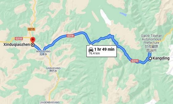
On the early morning of October 09, we check out of our lodging hotel in...
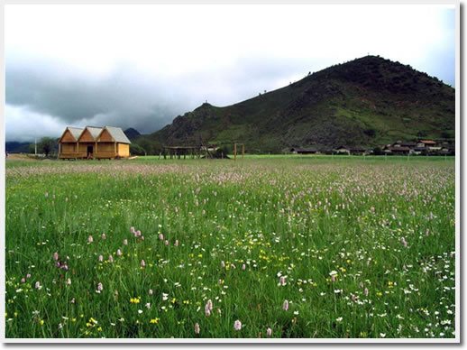
It is a town at 3450 meters altitude comprised of just one street that is G318 passing through it. It is said that the 10km long National Highway G318 in Xinduqiao Town is regarded as "the Corridor of Photographers ".
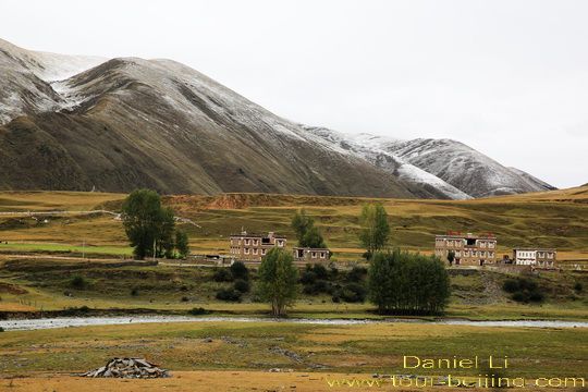
In autumn, the valley where Xinduqiao lies is a poetic and picturesque paradise. By the two sides of the highway and at the foot of the undulating mountains flanking it, you will see Tibetan blocks of houses, golden and yellow poplar trees, grazing horses, limpid streams, extending grasslands and magical lights ( especially at sunrise and sunset), a paradise of photographers!
China National Highway G318, oft-lauded as Route 66 & the National Old Trails Highway in the States, completed in 1954, runs almost along the NL30 degrees, and covers multiple landscapes seldom seen elsewhere in the world, ranging from the Yangtze River Estuary to Mt. Everest; from the basins regions to the plains areas and lofty plateaus; from mounds to hills, high mountains and alpine mountains; from fresh water lakes to saline lakes; from rain forests to bushes, grasslands, and wildness. Highway G318 is also a historical and cultural passage connecting the multiple cultures from the past to the present.
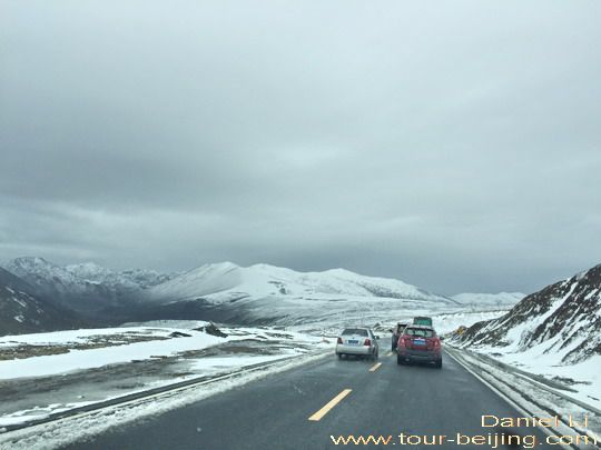
Last night we got a word that there started snowing around Zheduo Mountains Pass (折多山口). Zheduo Mountain Pass is the first pass at 4298 meters to enter the traditional "Kham" region, the typical Tibetan area in the west of Sichuan Province.
But when we are out on the Highway G318 this morning we find it is snowing everywhere around us, not just Zheduo Mountain Pass. We are carefully driving along the wide, but wet two-lane highway ( one lane for each direction) flanked by sheer cliffs or massive mountains.
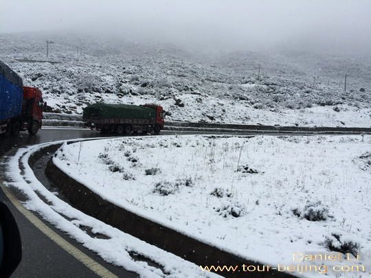
Not many vehicles on the zigzag maintain road. On the route, we pass through several service stops, very basic with simple toilets and parking lots, and you pay 5 yuan per vehicle to use the service for each stop. All the service stops are run by the local Tibetans.
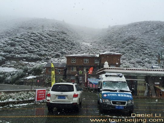
Zheduo Mountain Pass is a must stop on the way from Kanging to Xinduqiao or vice versa. At 12:30am we get to the flat top of the pass, and see a huge rock monument standing there engraved with the words"First Pass to Kham - Zheduo Pass 4298 " in English, Tibetan and Chinese. Behind the sign rock is a white pagoda surrounded by colorful prayer flags.
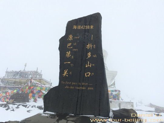
"Zheduo" 折多 in Tibet means "zigzag and bends". There are plentiful bends and curves of the highway winding through Zheduo Mountain as its name suggests. Zheduo Mountain is an important geogaphical dividing line: on the west is Qinghai-Tibetan Plateau; on the east and south is the high mountains and deep gorges; on the north is the place where Jiarong Tibetans live.
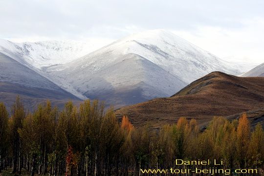
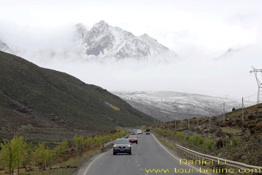
We slowly descend from the 4298-meter altitude pass, driving down along the switchback mountain roads. Soon we find the snow has stopped and it is getting brighter. This has really buoyed us up! The annoying snow has blanketed the otherwise coloful autumn hues of the mountains we have passed by. The snow has turned the autumn fairyland into a monotonous white world.
Around 2:00pm, we've smoothly descended from the cloud and snow capped Zheduo Mountain to the sightseeing highway not far from Xinduqiao Town at the fall of about 1000 meters.
We are excited to see the green and yellow trees and grassland on both sides of the highway. We stop by the roadside, taking out our cameras and getting ready for shooting the picturesque scenery.
For next two hours, we are experiencing a drive scenic tour along the highway in Xinduqiao, stopping where we think there is a photogenic spot.
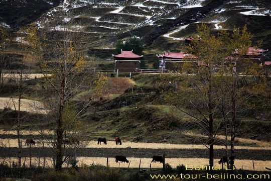
It is not a bright and sunny day, but we are very much satisfied with the weather - no rain with fairly good visibility. Dotted fallen snow, Tibetan houses, yellow poplar trees, grazing horses constitute a pristine and pretty picture.
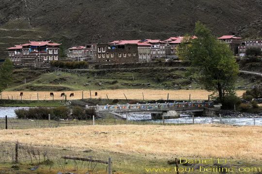
With a backdrop of the undulating mountains, Tibetan houses are scattered on the valley with the unlimited golden and yellow grassland; green and yellow poplar trees; limpid streams.
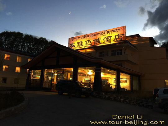
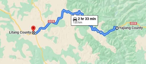
At 4:00 pm, we decide to continue driving west along G318 and stay overnight in Yajiang ( 雅江), 72km west of Xinduqiao. Our original travel plan was to stay overnight here in Xinduqiao.
If you don’t want to go the do-it-yourself route and prefer the hassle-free escorted tours, here are some options for Chengdu and Sichuan guided tours:
Share a question or note for this guide. Comments are reviewed before publishing.
Hand-picked routes matched from this article's destination clues, tags, and categories.
Use these attraction notes to connect nearby sights with tours, destination guides, and planning articles.
Continue planning with practical Beijing guides selected from similar places, themes, and travel questions.
Subscribe to receive Beijing travel ideas and tour updates.